


COPYRIGHT©2022 MUHANIT. ALL RIGHTS RESERVED. Designed by WebSite.co.kr
HOME >BUSINESS > NOTICE
NOTICE
Successful completion of the construction of high-precision electronic maps in Goyang City _ MuhanIT
마스터
2025-03-19
Number of views 2,914
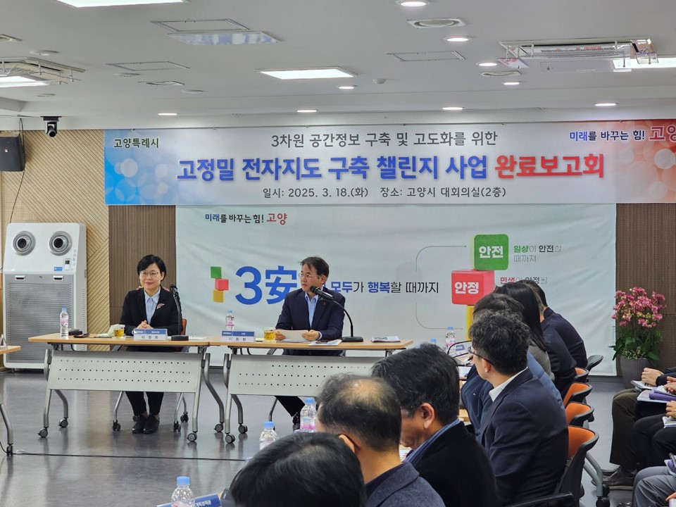
On March 18, a report on the completion of the "high-precision electronic map construction challenge project" was held in the conference room of the main building in Goyang City.
▶ Read More https://blog.naver.com/muhan_it/223801951701
[Overview of the final report]
1) Date/Location
- March 18, 2025 (Tue) 10:00 to 11:00 / Conference room (2nd floor of main building)
2) Subject to attendance
- Goyang City: Mayor, Second Deputy Mayor, Head of Urban Housing Policy Office, Land Information Division, Related Departments (Director, Team Leader, etc.)
- Company: Samah Aerial Survey Consortium (Samah Aerial Survey, MuhanIT, Myeonghwa Geographic Information, Korea SGT)
- Experts: Six advisors, including public institutions, professors, researchers, private enterprises, etc
It is the first single project in Korea to build high-precision digital topographic maps (1:1,000), drone precision images (3cm), and 3D spatial information across the city, and it is expected to be a cornerstone for the development of smart cities in Goyang City in the future.
In particular, by establishing a key data base for the creation of a smart city based in Goyang, it is expected that administrative services using efficient electronic maps will be provided in various fields such as land administration, disaster response, transportation and environmental management as well as urban planning in the future.
The Samah Aerial Survey Consortium (Samah Aerial Survey, MuhanIT, etc.), which carried out the project, demonstrated digital twin-based three-dimensional urban planning simulations with the latest technologies, drawing great attention from participants.
▶ Read More https://blog.naver.com/muhan_it/223801951701
MuhanIT CO.,
Registration # : 873-88-00217 CEO : KyungRok Bae, MyungHwa Lee
HQ : #706, 12, Dangsan-ro 2-gil, Yeongdeungpo-gu, Seoul, Republic of Korea Direction
Branch : #302, Gwangju Institute of Industrial-Academic Convergence Research, 365, Bitgeurinsandan-ro, Gwangsan-gu, Gwangju, Republic of Korea
T. 02-6952-0825 F. 02-6952-0826 E. admin@muhanit.kr Privacy Policy
