Site Reality Platform
Go to About Us
Geo Fusion Platform Provider
Go to About Us


AI Model
Development

3D Modeling &
Digital Twin

Drone & IoT
Convergence

Intelligent Geospatial
Information Platform
Drone control and fleet management SW (Levle1 grade GS(Good Software) certified)
Unmanned control and sum of IoT sensor for drone BVLOS
Image-process, 3D modeling based automated SW (Levle1 grade GS(Good Software) certified)
Provide RGB 3D modeling based digital twin and metaverse environment
Artificial intelligent image decipher SW
AI dataset process, advice learning model, dev of GIS categories
1st grade GS(Good Software) certified
Real-time monitoring system for disaster area and risk management
Pavement management solution
One-cycle pavement process including inspection method
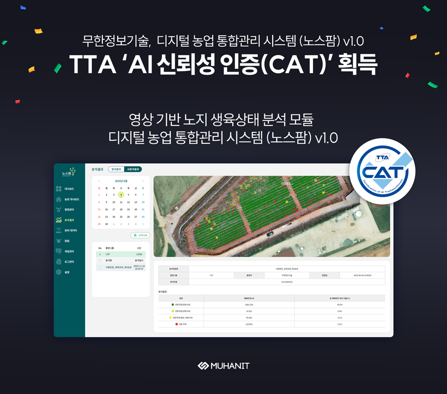
Harvest area / plant health management SW
GIS software for harvesting and method on health management
Dam safety inspection solution
Automation of 3D modeling from images from drones, AI crack inspection
for safety check workflow
Road-i Monthly updated road-view data matching service
Drone-i Drone fleet management, 3D modeling station

Individual
research

Open
heart

Consider
others


 MuhanIT’s News