


COPYRIGHT©2022 MUHANIT. ALL RIGHTS RESERVED. Designed by WebSite.co.kr
HOME >BUSINESS > SOFTWARE
SOFTWARE
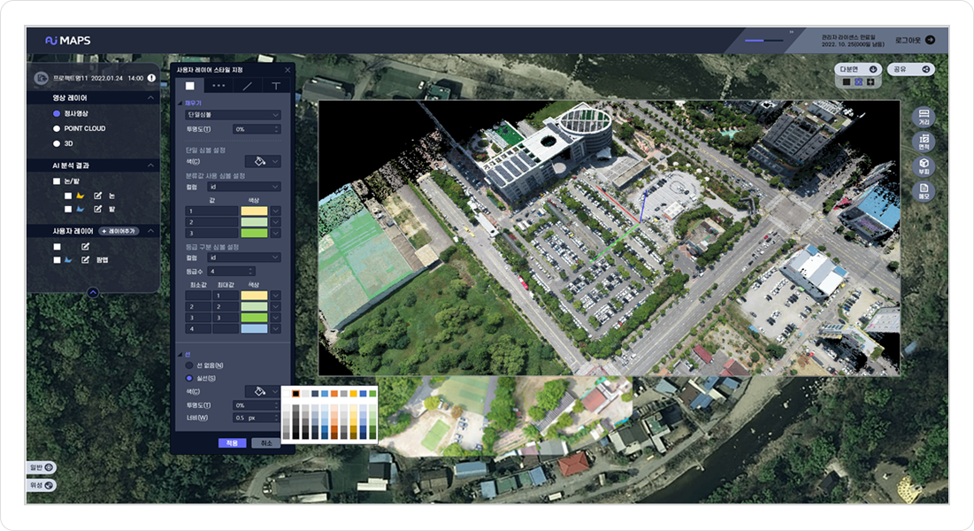
AiMAPS GeoAI
- Function for AI analysis tool such as learning and decipher
- AI dataset process, advice learning model, development and GIS viewer
- Farm harvest area, plant health and aerial photography detection function

AiMAPS 3DMapper 

- Drone unmanned fleet management for BVLOS
- Capable of LTE/5G network communication
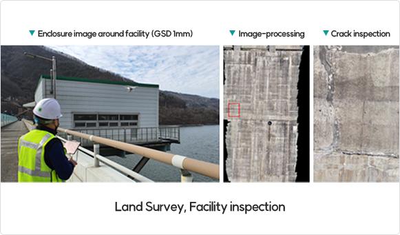
- Survey and construction site work and management support
- Smart safety inspection diagnosis support for large structures
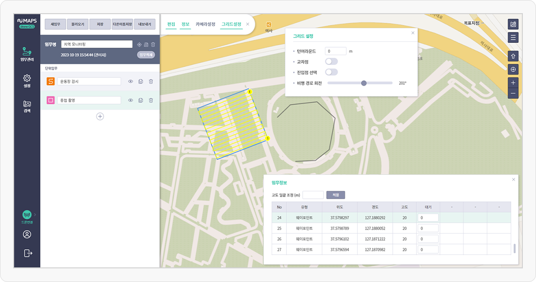
AiMAPS DroneGCS
- Drone unmanned fleet management for BVLOS
- Capable of LTE/5G network communication
- Survey and construction site work and management support
- Smart safety inspection diagnosis support for large structures
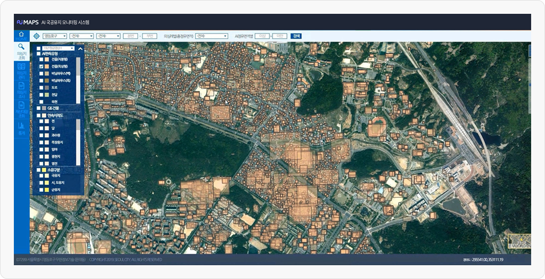
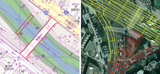
Build Survey / Database
Establishment of geo-spatial information service in GIS theme map, construction, underground image spatial information
and datasets for AI learning based on ICT technology such as Drone, MMS, LiDAR precise surveying equipment.
-
GIS Database
-
Geo-spatial information
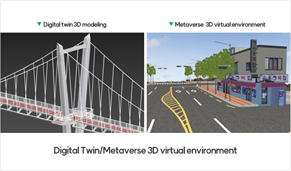
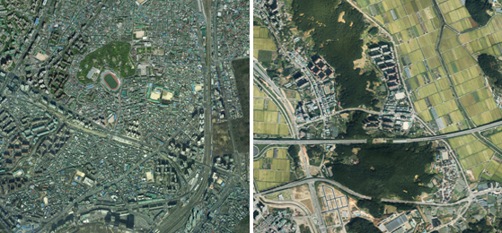
Drone service and 3D Modeling
Reality scan to build up Mirror World for each services from drone sensors (RGB, Multispectral, IR, LiDAR)
MuhanIT CO.,
Registration # : 873-88-00217 CEO : KyungRok Bae, MyungHwa Lee
HQ : #706, 12, Dangsan-ro 2-gil, Yeongdeungpo-gu, Seoul, Republic of Korea Direction
Branch : #302, Gwangju Institute of Industrial-Academic Convergence Research, 365, Bitgeurinsandan-ro, Gwangsan-gu, Gwangju, Republic of Korea
T. 02-6952-0825 F. 02-6952-0826 E. admin@muhanit.kr Privacy Policy
